Location-as-a-Service

Location-as-a-Service for a highly accurate localization

»Location-as-a-Service« (LaaS) hilft bei der Vernetzung verschiedener Verkehrsteilnehmer.
© Philipp Plum / Fraunhofer FOKUS

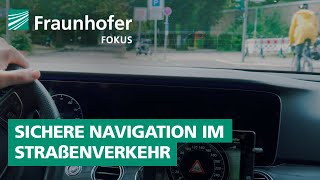
Assistance systems, such as GLOSA, collision warning, and Digital St. Andrew's Cross, can increase safety and comfort for road users, but also improve efficiency. For these assistance systems to be available to VRUs (“Vulnerable Road Users“) as well as passenger cars, highly accurate positioning is necessary. It is crucial to assign road users to the correct lane on a road, for example, to determine the correct traffic light sequence or to detect a possible collision.

GPS and other Global Navigation Satellite Systems (GNSS) often have a deviation of 5 meters or more when calculating positions. Since GPS positions on end devices are determined from the signals of satellites, there are various sources of error. Therefore, Fraunhofer FOKUS implemented Location as a Service (LaaS), a service that can improve users' positions as a Mobile Edge Cloud (MEC) service.

Visualisierung der verbesserten Lokalisierung mit LaaS: Die Positionierungen befinden sich zunächst neben dem fahrbaren Bereich und werden durch LaaS korrekt auf der Fahrbahn verortet.
© Fraunhofer FOKUS
A visualization of the improvement through LaaS can be seen in the figure below. The positioning is initially next to the drivable area and is correctly located on the roadway by LaaS.

Privacy warning

With the click on the play button an external video from www.youtube.com is loaded and started. Your data is possible transferred and stored to third party. Do not start the video if you disagree. Find more about the youtube privacy statement under the following link: https://policies.google.com/privacy

»Location-as-a-Service«: Safely through the city on foot, by bike or e-scooter

The LaaS client implementation is an easy-to-integrate software library developed by Fraunhofer FOKUS as part of the RealLabHH project, which uses the necessary GPS and sensor data from the smartphone in a privacy-compliant manner and sends it pseudonymized to the LaaS backend for position improvement. In the backend, other consumer components, e.g. a GLOSA server app can also be informed where relevant users are located.

An essential component for implementing LaaS is highly accurate HD maps of the target areas. While conventional SD maps are only suitable for navigating from A to B, HD maps provide highly accurate data about road topology. They contain information about the course of lanes and, in particular, how lanes are located and connected, as well as other localization features.

LaaS can be used on a bicycle or by e-scooter riders as well as in a passenger car. The library provided for this purpose can be integrated into smartphone apps or driver assistance systems. The smart combination of data from multiple users and an HD map can be used to determine a lane-accurate position for each road user.